A Trusted Provider
As a trusted provider of Master Data Management (MDM) solutions and services to government, utilities and commercial enterprises, Teranet improves the decision-making process by providing reliable property information, location intelligence capabilities and a world-class customer experience with these solutions.
Ontario Parcel
Streamline your business processes with Ontario’s most comprehensive land parcel dataset.
Title Data
All the property data you need in one convenient location.
Imagery
Teranet Imagery Partnership Program (TIPP) Advanced Imagery-Based Solutions.
Teranet Xchange
A world-class geospatial ecosystem to advance your business.
Easement Program
Proactively manage and protect easement interests in a reliable, secure, and centralized environment.
Featured Solutions
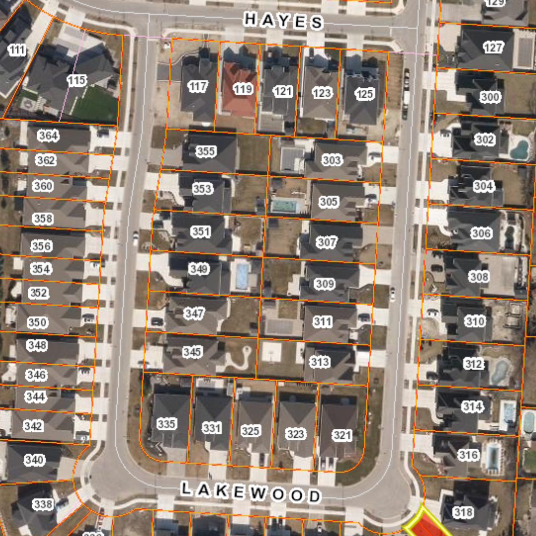
Ontario Parcel
Access information on 7.5 million parcels of land in Ontario to improve service delivery and give your clients and the public the customized information they want, quickly and easily.
Ontario Parcel is a consolidated collection of digital parcel mapping data that provides users with access to standardized and easily integrated information.
Title Data
Know more about the properties you’re working with sooner. Access data from the premium digital cadastral mapping solution in Ontario, including up-to-date title and property of interest reports.
Our Title Data Products let you know more, including Property Identification Numbers (PINs), legal information, ownership data and easements. Enhance your planning activities and make better decisions, faster.
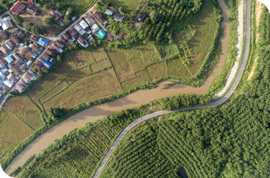
Teranet Imagery Partnership Program
The Teranet Imagery Partnership Program is designed to enhance our existing data sets and provide additional value-based solutions to our clients.
Through a consortium of partners, including Nearmap, First Base Solutions, QSP Geographics, Tulloch Engineering and Airborne Imaging, Teranet can provide a wide variety of imagery-based solutions and derivative products to enhance your organization’s GIS and workflow capabilities.
Teranet Xchange®
Teranet Xchange is designed for your modern needs, allowing you to fully integrate Teranet’s vital data into your business environment to enhance productivity and optimize workflows. This is the foundation for the seamless and efficient delivery of our most authoritative data and geospatial solutions. With options for real-time streaming or direct data delivery, Teranet Xchange will streamline your processes like never before.
Easement Based Solutions
For municipalities and utilities, the easements they own on a property are among their primary assets, yet these assets are often overlooked and poorly maintained. This unnecessarily exposes the organization to risks in asset management, infrastructure management, planning and development, and public safety.
Our comprehensive Easement Program features a suite of solutions to help you mitigate such risk by identifying and creating centralizing spatial easement data.
Geospatial Solutions Insights
Geospatial Solutions Insights