Registered easements are required for municipal staff, subcontractors, and equipment to gain access to municipal infrastructure during routine and emergency works, infrastructure replacement and new construction.
Many municipal and utility departments are dependent on current easement information and easement locations to mitigate risks associated with asset management, infrastructure operations, and public safety. This is especially challenging for small, yet growing, municipalities where data on easements may be incomplete, out-of-date and de-centralized.
As the leader in easement solutions, Teranet helps create centralized spatial easement inventories for our government and utility customers. One of our recent initiatives was an easement identification and mapping project for the Town of Tecumseh, located in Essex County in Southwestern Ontario.
Like many municipalities, the Town managed easement records in multiple systems across the municipality, but wanted to maintain and enhance easement data from a single location in a spatial environment. In order for the Town of Tecumseh to improve asset management and data accuracy, integrity, and accessibility, Teranet helped implement an easement project to identify, validate, and map easement data related to the Town’s infrastructure (Figure 1).
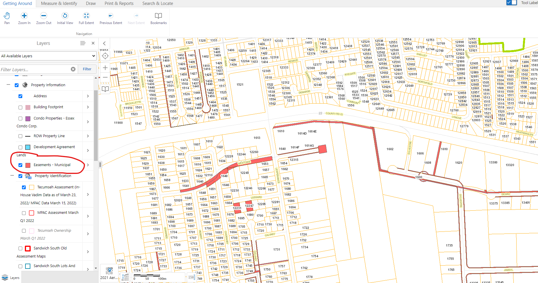
Figure 1. Town of Tecumseh Geocortex Online Mapping: Municipal Easements
The project involved the analysis of source Land Registry Office records to determine easement type instrument registrations in the Town’s favour followed by the review of the registered instruments to validate the Town’s municipal easements and easement purposes. Using the Ontario Parcel Ownership Mapping as a base, the limits of each easement were mapped based on registered plans and metes and bounds descriptions. Upon completion of the project, the Town received an Easement Mapping layer (Figure 2), custom Easement Reports, Registered Easement Instrument Images, and Registered Plan Images, enabling them to create a centralized spatial easement inventory.
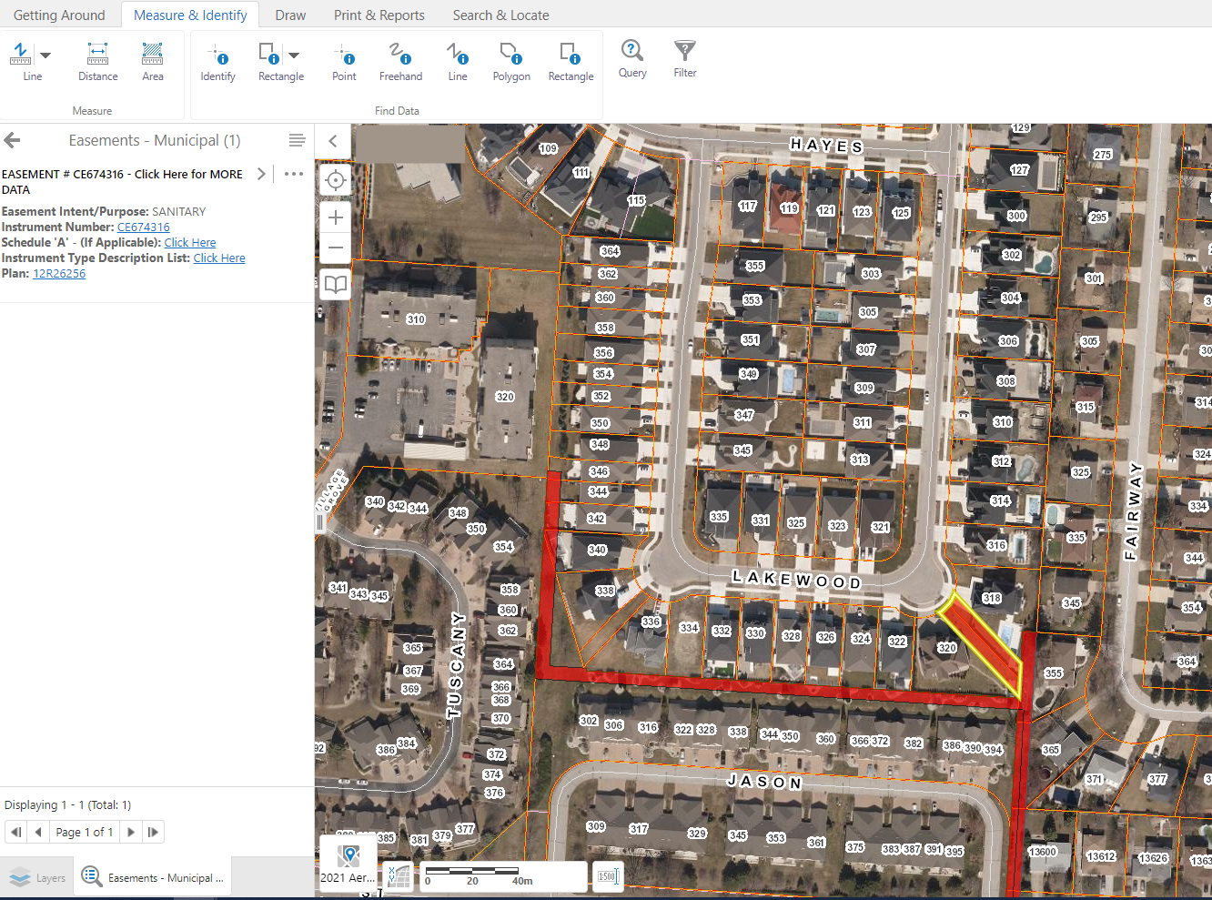
Figure 2. Town of Tecumseh Geocortex Online Mapping: Easement Layer SELECTION
Through Teranet, the Town now benefits from:
- A centralized spatial easement inventory with access to full easement details (Figure 3)
- The identification of missing, unregistered and misaligned easements
- Prioritized investigations and registered documents where easements were found missing
- The ability to link non-spatial infrastructure to the easement polygons in the Town’s GIS database
- Improved ability to value the Town’s assets
- Improved and standardized processes for future easement acquisition
- Formalized planning of releasing easements and overall risk mitigation
- The ability to prioritize easement related budget planning
- Enhanced municipal infrastructure GIS data
- Access to critical information for emergency response and field operations
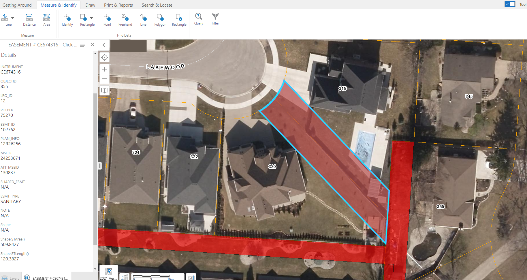
Figure 3. Town of Tecumseh Geocortex Online Mapping: Easement DETAILS
Today, the Town can better manage its assets and land resources related to improvement needs. Not only is the system more effective in saving staff valuable time, but it also reduces overall costs of easement management.
When important easement assets are overlooked or incomplete, municipalities and utilities are exposed to risk. Teranet is committed to helping government and utilities analyze and map easements and other land-related data to help them drive operational efficiencies with less risk.
Stay updated on news from Teranet and learn about our easement solutions! Follow us on Twitter and LinkedIn.