Asset management, infrastructure operations, public safety challenges, and not knowing “what you have where” present organizational risks. That’s why easement mapping is so important.
When mapping easements, working with incomplete or inaccurate easement information leads to gaps in your analysis. Legacy registration processes, siloed data, and a lack of complete, accurate, and centralized easement inventory are all challenges we see government and utility providers face.
Teranet data is derived directly from the land registry records, making it reliable, accurate, and complete. We have modernized our easement solutions for governments and utility providers with a flexible and phased-in approach, making easement mapping easier than it has ever been.
Our solutions for mapping easements ensure that you can:
- Create a centralized spatial easement inventory.
- Identify missing or misaligned easements.
- Prioritize investigations and register documents where easements were found missing.
- Improve and standardize your processes for future easement acquisition.
- Formalize the planning of releasing easements and overall risk mitigation.
- Prioritize easement related budget planning.
- Enhance municipal infrastructure GIS data.
- Access critical information for emergency response and field operations.
- Prioritize investigations and purchase missing easements.
- Access critical information for emergency response and field operations.
- Improve and standardize your processes for future easement acquisition.
- Formalize the planning of releasing easements and overall risk mitigation.
- Prioritize easement related budget planning.
- Enhanced municipal infrastructure GIS data.
- Create a centralized easement inventory.
Here is a preview of what our easement solutions can do for you.
Comprehensive Easement Reports
Our easement reports contain all registered easement type instruments within the desired jurisdiction. We can offer further customization based on Party To and Party From name matching to identify potential easements in the interest of your organization.
Document Review and Evaluation
Teranet reviews the registered easement type instruments identified in the easement report to validate the instruments where easements are created.
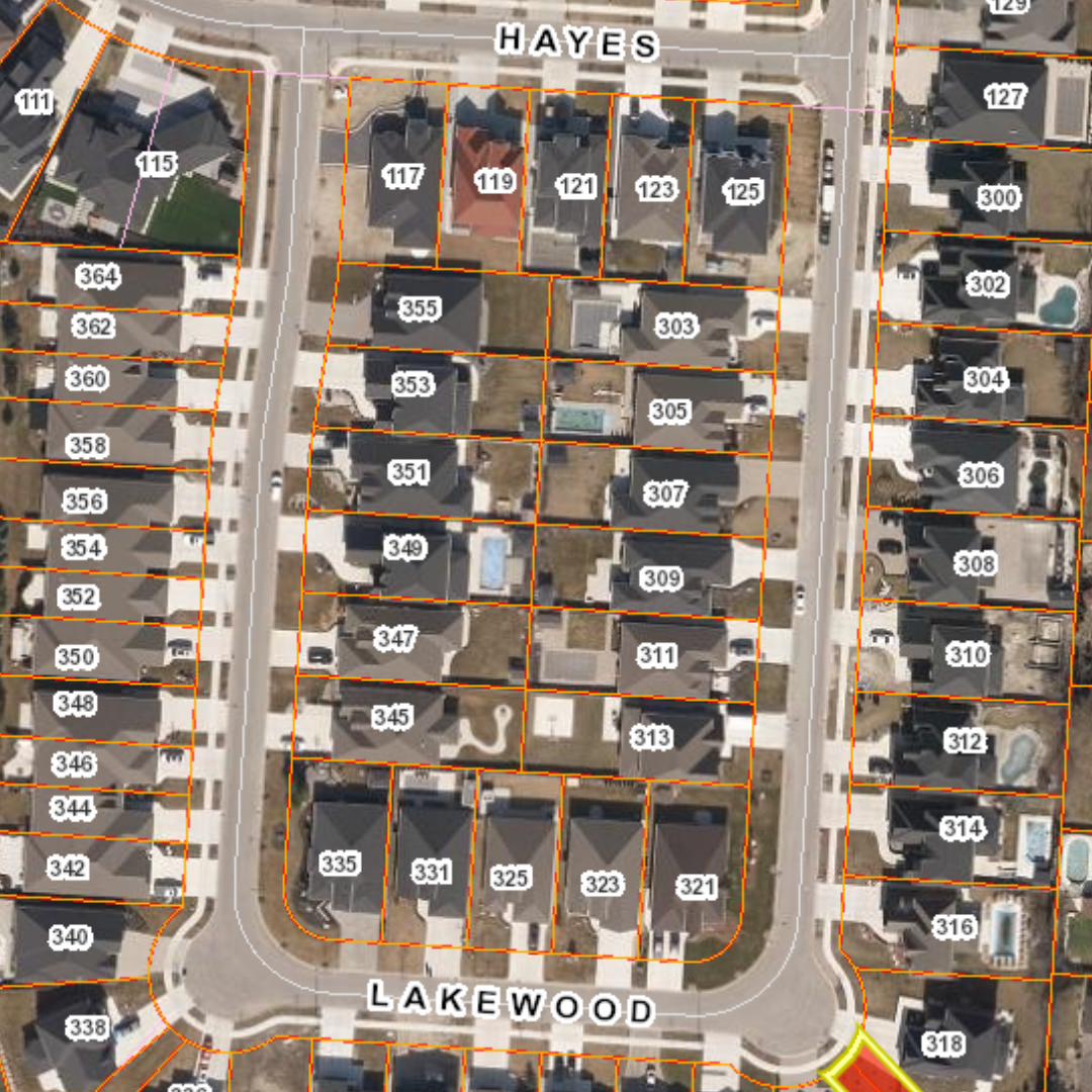
Easement Mapping
Teranet maps easements by generating polygon features that identify the spatial extent of the valid easement instruments based on the descriptions and plan information over the existing parcel mapping fabric.
Easement Purpose Identification
Teranet reviews the validated easement instruments to identify each easement purpose and associates its mapped easement polygon. i.e. stormwater sewer, sanitary sewer, etc.
Ongoing Easement Mapping Maintenance
Upon completion of an easement identification and mapping project, Teranet can provide map maintenance by monitoring new easements and release of easement registrations.
All in all, this means staff have access to solutions that provide an integrated approach to easements, which includes easement reports, instrument and plan images, and easement mapping data.
With easement mapping, now your organization can mitigate risks by having more control over your overall asset management, infrastructure operations, public safety, and awareness of “what you have where” in one solution tailored to your needs.
For more information about easement mapping, contact Richard Norris today.
Richard Norris
Senior Manager, Government & Utilities | Teranet Inc.
123 Front Street West, Suite 700, Toronto, ON M5J 2M2
Office: 416-643-1035 | Mobile: 416-529-9587
Email: richard.norris@teranet.ca